Key Points
- Category five cyclones are "incredibly dangerous".
- Ilsa was downgraded from a category five storm as it moved over land.
- Winds at its centre had reached 195 kilometres per hour.
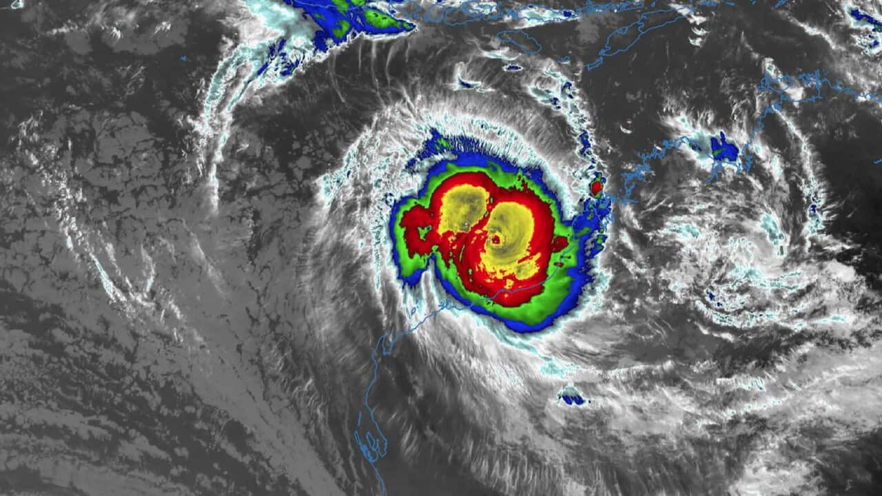
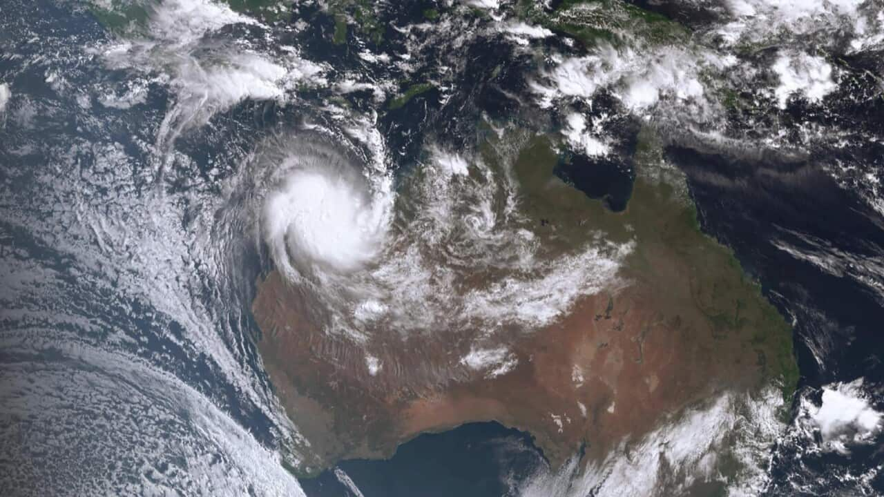
Tropical Cyclone Ilsa has crossed Western Australia's northwest coast with potentially record-breaking winds, buffeting locked-down communities as it moves inland.
The cyclone hit the coast as a category-five system between De Grey and Pardoo about midnight on Thursday, bringing winds of 213km/h.
On Friday morning, it was classified as a category-three system and it was expected to maintain cyclone intensity until night as it moved hundreds of kilometres inland towards Telfer and Kunawarritji.
In the regional centre of Port Hedland, west of the storm's centre, locals were sheltering indoors under a red alert until the threat passed.
Mayor Peter Carter said the town of about 16,000 was still locked down and he had been unable to assess the damage, but the winds sounded "like a freight train" as the cyclone passed during the night.
"I think that we were very, very lucky. At the last point, the cyclone moved further north from us," he told ABC TV.
"So I think that we were spared in our community what could have been really bad."
Iron ore port and rail operations had been suspended at Australia's busiest and biggest port and ships sent away in preparation for the cyclone's approach.
The Bureau of Meteorology's Dean Narramore said Cyclone Ilsa was generating sustained offshore winds gusts of up to 289km/h at Bedout Island before measurements stopped working.
He said the cyclone might have delivered a new record for sustained wind speeds in Australia and the danger wasn't over for remote communities in the interior of Western Australia and the Northern Territory.
"It's likely to lead to flash and riverine flooding and a lot of the dirt roads in this part of the world becoming unusable and could see some brief isolation of communities and property owners and residents," Mr Narramore said.
The bureau said very destructive winds with gusts of up to 220km/h were hitting near the cyclone centre to the east of Marble Bar on Friday morning.
Heavy and intense rainfall was expected to continue in the cyclone's path, including falls of up to 200mm during the day.
Speaking before the cyclone struck, the manager of the remote Pardoo roadhouse, Will Batth, said he was planning to stay onsite and hunker down with a colleague when the storm hit.
"We haven't had any as strong as this in many years. This is a big one," he said.
"[But] there's no point in worrying. I can't stop it."
Warrawagine cattle station manager Belinda Lethbridge said the situation was concerning but her team had prepared as much as they could and it was now down to luck.
She said her family and staff would sit out the cyclone together and expected to be flooded in by swollen rivers after it passed.
Department of Fire and Emergency Services commissioner Darren Klemm said the weather system would have a significant impact on communities in the warning area.
"All the preparation work that's gone into those remote Aboriginal communities, the mine sites and the town and the pastoral stations is really critical to make sure people are staying safe," he said.
Evacuation centres were opened in South Hedland, Newman, Marble Bar and Nullagine.
Extra emergency workers, essential supplies and aircraft have been sent to the area.
