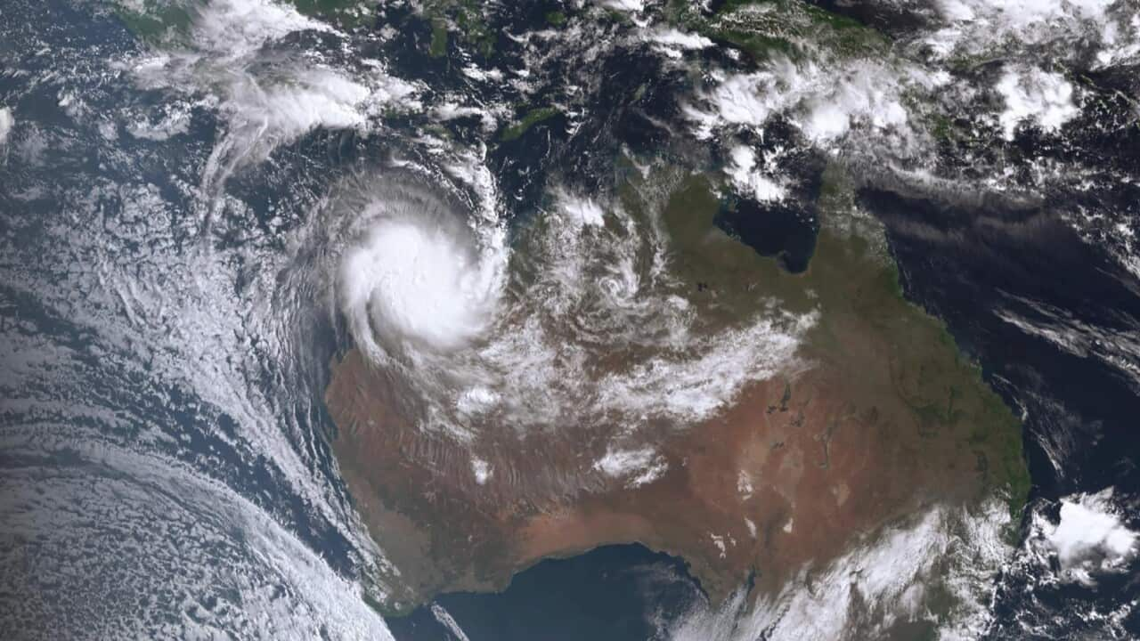
Authorities are bracing for a long night as tropical cyclone Ilsa heads towards the northern coast of Western Australia.
Currently designated a Category Four, the Bureau of Meteorology expects the system to be upgraded to a Category Five in the next forecast track map, due at midday local time.
The Category Five conditions are expected to persist as the cyclone makes landfall at the southern end of 80 Mile Beach late this evening or early tomorrow.
"With a Category Five system, we're talking winds in excess of 280 kilometers an hour," said Jessica Lingard, a meteorologist with the Bureau of Meteorology.
"We're going to see caravans picked up trailers, boats, trampolines, your garden wheelie bin, significant roofing loss and structural damage, dangerous airborne debris and widespread power failures," she told NITV.

Cyclone Ilsa's destructive path, which includes winds above 200 kilometres/hour, could stretch as far inland as the Northern Territory border.
"Along the coastline we're also going to see increased seas and swells in excess of eight meters," said Ms Lingard.
"We could see between 300-400 millimeters of rainfall today and tomorrow. So that could lead to some flash flooding and riverine flooding through the area as well."
The affected area stretches from south of Broome past Port Hedland and down to Whim Creek. As the hurricane moves inland, communities at Marble Bar, Nullagine, Telfer, Parnngurr and Kiwirrkurra will also be struck.
With the Great Northern Highway between Roebuck Roadhouse and Port Hedland expected to be imminently closed, residents in those areas have been advised to put cyclone plans into action and head for the nearest evacuation centre or safe space.
"Keep your emergency kit with you move your vehicles undercover. Fasten your cyclone screens, board up or heavily tape exposed windows and ensure your pets and animals are in a safe area," said Ms Lingard.
Communities on NT border could be affected
Cyclone Ilsa is the first Category Five system to cross the state's coast in 14 years, the most recent being Cyclone Lawrence in December 2009.
However Cyclone Ilsa's expected path deep into the country's inland makes it an especially dangerous cyclone.
While the coastal towns will receive the brunt of Ilsa's force, communities as far inland as the Northern Territory border are being warned to prepare.
"This system will still be very strong as it moves through tomorrow.
"It could still be a Category Three system as it moves past Telfer, and [at] Kiwirrkurra, where the system could still be as strong as a Category One.
"So we do need all people in the path of this system to start to prepare for this severe weather over the next 24 to 36 hours."


