TRANSCRIPT:
You may have been hearing the term 'El Nino' recently, being used to describe Australia's summer outlook.
So what is it?
El Nino is a climate driver which heavily influences Australia's weather.
It's a part of a natural cycle associated with a sustained period of warming in the central and eastern tropical Pacific.
Many nations around the world have already declared the event to be occurring, but Australia's Bureau of Meteorology has not.
Bureau climatologist Caitlin Minney says that's because an El Nino event is likely, but it hasn't started yet.
"So the bureau is looking at both oceanic and atmospheric indicators before we declare an El Nino event underway. So each country has different criteria for how they define an event. And that depends on the conditions and impacts individual to that country. And the Bureau's criteria suits Australia best. We're waiting for a sustained atmospheric response before we declare an El Nino event."
El Nino events typically deliver drier conditions and above average temperatures for much of the country, but particularly in the east.
They occur when sea surface temperatures in the central and eastern Pacific Ocean become substantially warmer than average.
That causes a shift in atmospheric circulation, altering wind patterns that influence the kind of weather Australia gets.
The bureau's latest advice suggests the prospect of another driver of dry weather in Australia - a positive Indian Ocean Dipole - is firming.
Janette Lindesay is a Climatologist at the Australian National University.
"Although the sea surface temperature pattern that we associate with El Nino has developed very well in the eastern Pacific. So we have a big warm pool of water extending from the South American, Central American coast towards Australia. The sea surface temperatures off the Australian northeast coast have not yet fully developed into an El Nino pattern. We expect those temperatures to get cooler than average. And that hasn't really happened yet, although there are some early signs that it might be starting."
Dr Simon Heemstra is the Director of Community Risk at the New South Wales Rural Fire Service - which works with the Bureau closely to produce its summer outlook.
He says the service is expecting drier conditions.
"For this summer, what the weather's gonna be like and what the fuel situation which gives us our fire outlook for the season. The weather forecast for New South Wales the climate outlook is showing us that there's a much higher than average potential of having below average rainfall so a dry summer and a very strong signal for being much warmer than average both days and night. So looking at a drier warmer summer coming into this season."
The prospect of hotter and drier weather has authorities concerned.
The country is emerging from three years of wet conditions and flooding, which fuelled heavy vegetation growth.
Once all that growth dries out, Australia will have heavy fuel loads for bushfires.
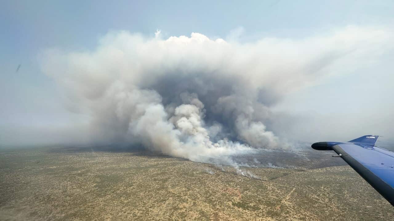
There have already been major bushfires in the Northern Territory, and significant early-season fire activity in Queensland and Victoria.
Dr Heemstra says people who live in bushfire prone areas should start preparing for drier and warmer conditions now.
"We've had a series of quite wet years. And it's important for people to realise that we're now going into a summer where we could be experiencing significant fire behaviour. The messaging for the community that live in those areas is to understand that there is a real potential for bushfires this season. It's important that they take steps to prepare for that, and particularly looking at what they can do around their property with removing flammable materials and cleaning gutters around the yard."
Meanwhile Caitlin Minney says the Bureau is keeping a close eye on conditions.
"We currently remain at El Nino alert, meaning that there is about a 70 per cent chance of an El Nino developing in the coming months. We're also closely monitoring a positive IOD that we're watching if it's developing in the Indian Ocean and a positive IOD generally means warmer conditions and also drier conditions around southern and eastern Australia. So if we continue to see further positive values, we will be looking at an event there."


