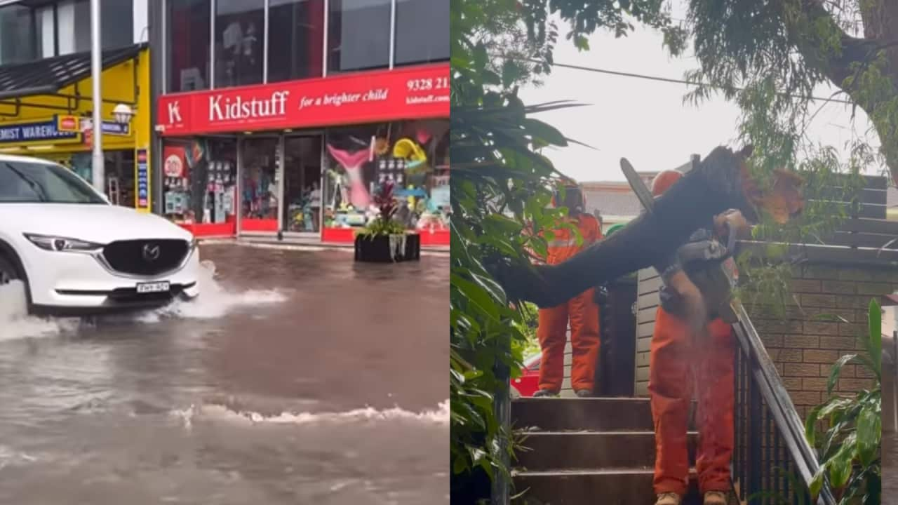
Parts of eastern Australia have been inundated by rain and , with flash flooding in Sydney and south-east Queensland.
According to Weatherzone, parts of Queensland, NSW, the ACT, Victoria, Tasmania and South Australia all received their heaviest rainfalls in years.
Storms swept across Victoria early in the week, bringing severe thunderstorms and intense localised rainfall on 26 and 27 November.
Victoria State Emergency Service (VICSES) reported more than 670 calls for assistance, including over 130 requests for help due to flooding.
VICSES state agency commander David Baker said it's "important for Victorians not to become complacent around the threat of storms" as the state enters the year's hottest months.
The Bureau of Meteorology (BoM) issued warnings for 10 rivers in Queensland on Monday. The Gold Coast hinterland was hit with over 200mm of rain in under 24 hours, while parts of Brisbane were submerged by flash flooding.
A spokesperson for BoM told SBS News Brisbane experienced rapid and heavy rainfall due to slow-moving storms in the area.
"We saw rainfall amounts in Brisbane City up to 51 mm in half an hour, so quite heavy, short-duration rainfall, and that's what really triggers that flash flooding."
Weatherzone said some river levels rose "by about 10 metres in under 12 hours, catching many nearby residents and travellers by surprise".
"Roads were cut off, forcing drivers to abandon their vehicles and call for help," the weather app said.
Parrakie, a small town in the south-east of Adelaide, received its heaviest rain in seven years, while Eaglehawk Neck in Tasmania experienced its heaviest in more than four years.
In Sydney, Double Bay in the eastern suburbs was hit by flash flooding caused by a rapid downpour, submerging streets and flooding stores.
The NSW State Emergency Service (SES) urged people to remain vigilant on the roads and water over the summer.
It responded to more than 900 incidents last week as storms battered the state. Flood watches are currently in place for 13 catchment areas, including the Colo River, Macquarie River and Orara River.
Australia is likely to experience above-average rainfall over summer, particularly during December, according to BoM, with an increased chance of unusually heavy showers in parts of eastern and north-western Australia.
Dr Andrew King, a lecturer in climate science at the University of Melbourne, told SBS News summer is typically Australia's season for extreme weather events and the recent storms and downpours have been caused by unusually high humidity due to warm seas.
"We've got a few ingredients coming together and we've also had some low-pressure systems and troughs ... that kind of combination of instability and lots of moisture around is basically what's brought all the storms," he said.
The BoM spokesperson said the warm seas off the coast of eastern Australia have also resulted in higher-than-usual humidity on a daily basis.
"In the last couple of weeks we've seen humidity levels in Brisbane be more similar to those we seen in Darwin at this time of year."
'Never drive in floodwaters'
NSW SES acting assistant commissioner Paul McQueen urged people to stay across the latest weather warnings and never drive through floodwater.
"The message is simple — please never drive, ride, or play in floodwaters," he said.
"I also want to thank those who do the right thing and turn around to find another way. By doing this, you are saving our volunteers from being put in harm's way," McQueen said.
He said people in NSW need to plan ahead for the storm season.
"Travellers heading to caravan parks and resorts in low-lying areas should have a plan and prepare for possible heavy rain, which can lead to flash flooding and riverine rises."
Climate change driving flash flooding and extreme rainfall
King said climate change is driving an increase in flooding events around the world as warmer air can hold more water vapour, leading to more intense rainfall.
"You can get slightly heavier rainfall, more intense extreme rainfall in particularly over a very short time scale, so downpours that happen over the course of half an hour or an hour and cause flash flooding and those kind of events, we think are generally worsening as we warm the planet," he said.
Australian researchers have predicted that rain events leading to flooding over a 24-hour period are likely to increase by 8 per cent for every degree of warming, while hourly rainfall extremes are expected to rise by around 15 per cent per degree of warming.
According to CSIRO's State of the Climate report published in October, "heavy short-term rainfall events are becoming more intense".
King said flash flooding is caused by a combination of factors, but it typically results from extreme rainfall over a short period that the ground can't absorb and infrastructure can't handle.
While Australia is fairly used to extreme weather events, he said the impact of climate change "hasn't previously been well accounted for" in the design of infrastructure in Australian cities.


