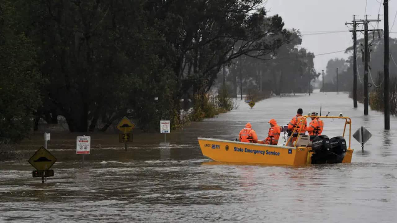
總理艾巴尼斯(Anthony Albanese)宣布向新州受影響的23 個地方政府居民,發放水災災難善後補助金。
雪梨西北部的溫莎河(Winsor River) 流域出現了 44 年來最嚴重的洪水,水位已上升了 13.8 米,超過3月洪災的最高位。
天空新聞氣象學家夏普(Rob Sharpe)表示,大部分受影響地區在Hawkesbury-Nepean一帶,該河系蜿蜒在雪梨西部和北部。
夏普說:「總體而言,這是該流域最嚴重的洪水事件,以往僅發生在河流系統的一部分。但今次事件影響整個流域,現在多個地區的災情是近年來最嚴重。」
在洪水區,現時約有 50,000 人被命令需要撤離。國家緊急服務中心 (SES) 已收到 500 多個求助請求。
目前豪雨已經從雪梨緩解並已向北移動,這意味著洪水威脅已影響至城市北部。
洪水的衛星圖像
從芬蘭衛星公司 ICEYE 發布的衛星圖像顯示,可看到Hawkesbury - Nepean兩岸的洪水非常嚴重。ICEYE 的衛星圖片為政府和保險公司提供洪水的數據。
以下為Windsor和Richmond動畫衛星圖片。
動畫圖片中看到,在7 月 4 日發生豪雨前和後,Hawkesbury 河水(藍色部分)流經Windsor和Richmond地區的情況,當中有許多小支流匯入主河。可見豪雨發生後的可怕情況,大片藍色顯示洪水擴散至很遠地區,表示了兩地的所有支流向Hawkesbury 河流流注入大量洪水。 Richmond空軍基地是澳洲皇家空軍最大的空軍基地之一,位於中心位置,暫時並未受影響。

The animations show the comparison between water levels during normal conditions, and then the status of Richmond, and Windsor areas when ICEYE’s initial release of flood depth analysis was finalized on July 4. Source: ICEYE
而最新的Windsor Bridge今年第二次被洪水淹沒。
Windsor 和Richmond的部分地區——以及附近的 Cattai、Pitt Town 和 Wisemans Ferry——現時需要撤離。
雪梨西南部的Camden也遭遇百年一遇的洪災。洪水使Nepean 河水位不停上漲,無數家庭需要緊急撤離。
以下為Camden衛星圖片。
顯示Nepean河在7 月 4 日發生豪雨前後的變化。 衛星圖像顯示洪水造成的破壞,讓其中心地帶變成了一個半島。幾條街道消失於水底下。

The animations show the comparison between water levels during normal conditions, and then the status of Camden areas when ICEYE’s initial release of flood depth analysis was finalized on July 4. Source: ICEYE
以下動畫照片顯示(7 月 3 日)和之後(7 月 6 日),在Newcastle附近的 Tomago、Beresfield 和 Thornton 洪水情況。

Satellite photo animation showing a before (July 3) and after (July 6) of the flooding near Tomago, Beresfield and Thornton, not too far from Newcastle Source: ICEYE
North Richmond、Windsor、Sackville、Lower Portland 和 Wisemans Ferry 正在經歷大洪水。Penrith 正在發生輕微的洪水。
Wallacia 的Nepean 河上游發生中度洪水,Menangle 發生輕度洪水。
Image
SBS 中文堅守《SBS 行為守則》及《SBS 編採指引》,以繁體中文及簡體中文提供公平、公正、準確的新聞報道及時事資訊。作為一個公共服務廣播機構,SBS 的主要作用是提供多語種媒體服務,為全體澳洲人提供資訊、教育性及娛樂性內容,並與此同時反映澳洲多元文化社會的特色。SBS 廣東話及 SBS 普通話電台節目均已為大眾服務超過 40 年。


